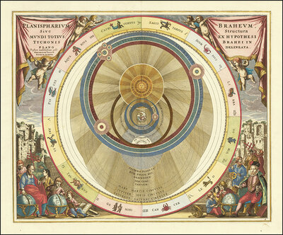
Planisphaerium Braheum, a famous historical celestial map illustrating the geo-heliocentric world model of the Danish astronomer Tycho Brahe. The engraving is by Andreas Cellarius and was published in 1660 or 1661 in the Atlas Harmonia Macrocosmica. At th
Prüfen Sie vor dem Kauf jedes Pixel – Sie bekommen genau die Datei, die Sie im Zoom sehen.
Bezahlung per PayPal oder Banküberweisung (Vorkasse)
Angebot erstellen (PDF)
Projekt zu diesem Motiv anfragen
Sondergrößen, exklusive Lizenzen, Druckberatung
✓ Originalaufnahme – echte Gigapixel-Fotografie, kein KI-Upscaling
✓ Download-Link per E-Mail – Nach der Zahlung erzeugen wir Ihre Originaldatei. Den Download-Link erhalten Sie per E-Mail, meist innerhalb weniger Minuten, spätestens nach etwa einer Stunde.
✓ Rechtssichere Lizenz – für Druck, Spanndecken & Wandgestaltung
✓ Persönlicher Support – Bei Fragen oder Problemen schreiben Sie uns oder rufen Sie an: info@gigapixel.gmbh+49 3643 25146-80
✓ Download-Link per E-Mail – Nach der Zahlung erzeugen wir Ihre Originaldatei. Den Download-Link erhalten Sie per E-Mail, meist innerhalb weniger Minuten, spätestens nach etwa einer Stunde.
✓ Rechtssichere Lizenz – für Druck, Spanndecken & Wandgestaltung
✓ Persönlicher Support – Bei Fragen oder Problemen schreiben Sie uns oder rufen Sie an: info@gigapixel.gmbh+49 3643 25146-80
Dateigröße:
13512 * 11273 px
Dateiformat:
TIF
Fotograf:
imageBROKER/Sunny Celeste
Historische kosmologische Himmelskarte nach Brahe-Hypothese. Konzentrische Planetenbahnen um Erde mit aufwendiger Radialzeichnung. Renaissance-Kolorit mit Gold, Creme und zartem Blau. Begleitet von gelehrten Figuren und Cherubinen in den Ecken.
Ähnliche Bilder
🖼 0.97
art
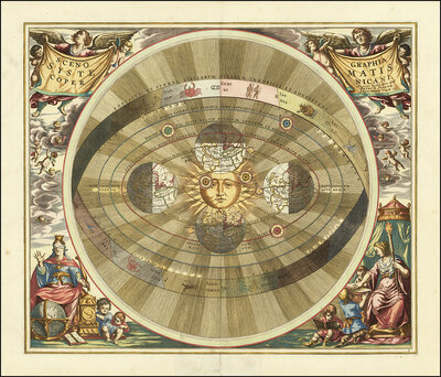
A 17th century illustration of Tycho Brahe's geo-heliocentric model of the universe. The image is from Andreas Cellarius' Harmonia Macrocosmica atlas and shows the Earth in the center around which the Moon and Sun revolve. At the same time, the planets Me
Kosmologisches Universum-Diagramm
Historisches kosmologisches Diagramm aus dem 16. Jahrhundert zeigt das geozentrische Weltbild mit konzentrischen Planetenbahnen um die Erde. Prächtige…
Details
🖼 0.96
art
Historical map titled Scenographia Systematis Copernicani, scenography of the Copernican system. It comes from the Harmonia Macrocosmica sky atlas by Andreas Cellarius, which was published in 1660/1661 and represents Nicolaus Copernicus's heliocentric wor
Geozentrisches Weltmodell
Historische kolorierte Kupferstichdarstellung des geozentrischen Weltbildes mit der Sonne im Zentrum, umgeben von konzentrischen Kreisbahnen. Allegorische…
Details
🖼 0.95
art
Scenographia Systematis Copernicani, scenography of the Copernican system. It comes from the celestial atlas Harmonia Macrocosmica by Andreas Cellarius, which was first published in 1660. The map illustrates the heliocentric view of the world as described
Kosmologisches Weltmodell
Historische kosmologische Darstellung mit geozentrischen Planetenbahnen um die Sonne, umrahmt von Engeln und allegorischen Figuren. Warme Goldtöne, detaillierte…
Details
🖼 0.95
art
Planisphaerium Copernicanum sky diagram by Andreas Cellarius. It comes from his atlas Harmonia Macrocosmica, which was first published in 1660/1661. The map illustrates the heliocentric world view based on Nicolaus Copernicus, in which the planets Mercury
Heliozentrisches Sonnensystem
Historisches Kupferstich-Diagramm des heliozentrischen Weltmodells nach Copernikus. Konzentrische Kreise zeigen Planetenbahnen um die Sonne, umrahmt von…
Details
🖼 0.95
art
Scenographia Systematis Copernicani, scenography of the Copernican system, a celestial map illustrating the heliocentric world view, from the atlas Harmonia Macrocosmica seu Atlas universalis et novus published in 1660 by Andreas Cellarius, a German-Dutch
Kosmologisches Modell, Sonnensystem
Historische kosmologische Darstellung mit geozentrischer Weltansicht. Zentrale Sonnenfigur umgeben von konzentrischen Planetenbahnen, reichhaltig dekoriert mit…
Details
🖼 0.95
art
Planisphaerium Arateum, part of the famous celestial atlas Harmonia Macrocosmica by Andreas Cellarius. Description The map shows the geocentric world view based on the observations and writings of the ancient Greek poet and astronomer Aratos (ca. 315 - 24
Geozentrisches Planetarium
Historische kosmologische Darstellung des geozentrischen Weltbildes mit konzentrischem Orbitsystem, Planetenscheiben und mythologischen Figuren. Prächtige…
Details
🖼 0.95
abstract
Historical astronomical map Theoria Lunae, Eius Motum per Eccentricum et Epicyclum Demonstrans, The theory of the Moon, which demonstrates its movement through eccentricum and epicycle. It is by Andreas Cellarius and was first published in 1660 in the fam
Kosmologisches Diagramm
Historische kosmologische Diagramm-Illustration mit geozentrischen Planetenbahnen, umrahmt von Putti und mythologischen Figuren. Antike Kolorit in Creme, Rosa…
Details
🖼 0.95
abstract
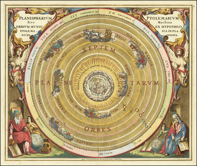
Presentation of the geocentric world view based on Claudius Ptolemy, as illustrated by Andreas Cellarius in 1660. This model assumes that the Earth is at the center of the universe and that all celestial bodies orbit it. The illustration shows the Earth i
Ptolemäisches Planetariumsmodell
Prächtiges historisches Planetarium nach Ptolemäus mit konzentrischem Orbitalmodell. Zentrale Erdkugel von golden leuchtenden Sphären umgeben, flankiert von…
Details
🖼 0.94
art
Orbium Planetarum Terram Complectentium Scenographia by Andreas Cellarius, a famous sky map that was first published in 1660 in his atlas Harmonia Macrocosmica. Geocentric world view, the map shows a three-dimensional projection of the Ptolemaic system, i
Kosmologische Himmelskarte
Historische Himmelskarte mit konzentrischem Zodiakus-Modell und lateinischen Inschriften. Barocke Kolorierung mit Engeln und Allegorien. Cremefarbener…
Details
🖼 0.94
art
Historical celestial map depicting the Ptolemaic, geocentric, world view. The illustration comes from the atlas Harmonia Macrocosmica by the German-Dutch cartographer Andreas Cellarius and was originally published around 1660 or 1661. The planets Luna, Me
Ptolemäische Himmelskarte
Historische Ptolemäische Himmelskarte mit konzentrischem Planetensystem. Aufwendig verzierte Kartusche mit Putten und Gelehrten in Renaissance-Stil. Warme…
Details
🖼 0.94
art
Historical astronomical map titled Planisphaerium Copernicanum. It comes from the atlas Harmonia Macrocosmica by the German-Dutch cartographer Andreas Cellarius, and shows the Copernican, heliocentric view of the world, which focuses on the sun, digitally
Kopernikanisches Sonnensystem
Historisches Planisphärium des Kopernikanischen Systems aus dem 17. Jahrhundert. Konzentrische Kreise zeigen das heliozentrische Weltbild mit der Sonne im…
Details
🖼 0.94
art
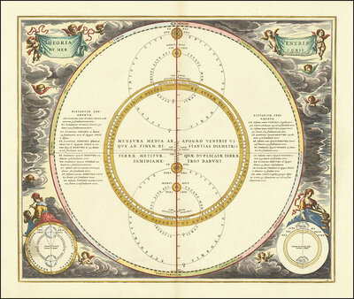
Historical illustration of the orbits of Mercury and Venus, which demonstrates the geoheliocentric world view according to Tycho Brahe. Theoria et Mercurii Veneris Cursus, theory and career of Mercury and Venus and depicts Mercury and Venus orbiting the S
Astronomische Diagramm-Illustration
Historische astronomische Darstellung mit konzentriscchen Kreisen und lateinischen Beschriftungen. Barocke Engel und allegorische Figuren umrahmen die…
Details