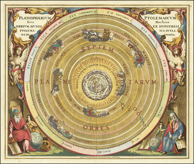
Historical sky map with Ptolemy's geocentric world view. This illustration is from the famous sky atlas Harmonia Macrocosmica by Andreas Cellarius, which was first published in 1660. The model illustrates the theory that the Earth is at the center of the
Check every pixel before you buy – you get exactly the file you see in the zoom.
Payment by PayPal or bank transfer (in advance)
Create quote (PDF)
Ask about a project with this image
Individual sizes, exclusive licences, print advice
✓ Original capture – genuine gigapixel photography, no AI upscaling
✓ Download link by e-mail – After payment we generate your original file. You receive the download link by e-mail, usually within a few minutes, at the latest after about an hour.
✓ Legally secure license – for print, stretch ceilings & wall design
✓ Personal support – For questions or problems, write to us or call us: info@gigapixel.gmbh+49 3643 25146-80
✓ Download link by e-mail – After payment we generate your original file. You receive the download link by e-mail, usually within a few minutes, at the latest after about an hour.
✓ Legally secure license – for print, stretch ceilings & wall design
✓ Personal support – For questions or problems, write to us or call us: info@gigapixel.gmbh+49 3643 25146-80
File Dimensions:
13036 * 11158 px
File Format:
TIF
Photographer:
imageBROKER/Sunny Celeste
Historical celestial map of the Ptolemaic system featuring a central Earth sphere surrounded by concentric celestial spheres and astronomical construction lines. Ornate Renaissance illustration adorned with divine and human figures in corners, richly colored in cream, gold, and soft rose tones.
Similar Images
🖼 0.99
art
Historical sky map known as Scenographia Systematis Mundani Ptolemaic. It is a representation of Claudius Ptolemy's geocentric view of the world, in which the earth is at the center of the universe. The map is from the Harmonia Macrocosmica sky atlas by A
Historical cosmographic diagram of the geocentric universe featuring Earth at center surrounded by concentric celestial spheres with Latin inscriptions. Ornate…
Details
🖼 0.96
art
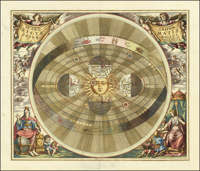
Scenographia Systematis Copernicani, scenography of the Copernican system, a celestial map illustrating the heliocentric world view, from the atlas Harmonia Macrocosmica seu Atlas universalis et novus published in 1660 by Andreas Cellarius, a German-Dutch
Historical cosmological diagram depicting geocentric worldview. Central sun figure surrounded by concentric planetary orbits, richly decorated with angels,…
Details
🖼 0.96
art
Ptolemaic Solar System, Scenographia Systematis Mundani Ptolemaici, 1660, digital improved reproduction of a work of Andreas Cellarius (1596-1665), a Dutch-German cartographer and cosmographer best known for his 1660 Harmonia Macrocosmica, a major star at
High-resolution digitization of the depiction of the Ptolemaic Solar System (Scenographia Systematis Mundani Ptolemaici) by Andreas Cellarius from 1660. The…
Details
🖼 0.95
art
Ancient star map, specifically a depiction of the southern hemisphere, Haemisphaerium Stellatum Australe. It shows mythological figures and creatures that represent the various constellations of the southern hemisphere and comes from the atlas Harmonia Ma
Historic celestial map featuring personified constellations and astronomical figures. Detailed Renaissance-style chart with allegorical representations in rich…
Details
🖼 0.94
art
Historical map titled Scenographia Systematis Copernicani, scenography of the Copernican system. It comes from the Harmonia Macrocosmica sky atlas by Andreas Cellarius, which was published in 1660/1661 and represents Nicolaus Copernicus's heliocentric wor
Historical colored engraving depicting the geocentric cosmological model with the sun at center surrounded by concentric orbital rings. Allegorical framed…
Details
🖼 0.94
art
Scenographia Systematis Copernicani, scenography of the Copernican system. It comes from the celestial atlas Harmonia Macrocosmica by Andreas Cellarius, which was first published in 1660. The map illustrates the heliocentric view of the world as described
Historical geocentric cosmological chart featuring planetary orbits around the sun, framed by angels and allegorical figures. Warm golden tones, detailed…
Details
🖼 0.94
abstract
Presentation of the geocentric world view based on Claudius Ptolemy, as illustrated by Andreas Cellarius in 1660. This model assumes that the Earth is at the center of the universe and that all celestial bodies orbit it. The illustration shows the Earth i
Magnificent historical Ptolemaic planetarium with concentric orbital model. Central Earth sphere surrounded by golden luminescent celestial spheres, flanked by…
Details
🖼 0.94
art
Haemisphaerium Stellatum Boreale cum Subiecto Hæmisphaerio Terrestri, Northern Star Hemisphere with the Earth's hemisphere below. It is a famous sky map from the Harmonia Macrocosmica, an important star atlas published in 1660 by German-Dutch cartographe
Historical celestial map with constellations in baroque cartography. Central depiction of northern hemisphere framed by putti and allegorical figures. Warm…
Details
🖼 0.94
art
Historical celestial map depicting the Ptolemaic, geocentric, world view. The illustration comes from the atlas Harmonia Macrocosmica by the German-Dutch cartographer Andreas Cellarius and was originally published around 1660 or 1661. The planets Luna, Me
Historical Ptolemaic celestial map with concentric planetary system. Ornately decorated cartouche featuring putti and scholars in Renaissance style. Warm earth…
Details
🖼 0.94
art
Planisphaerium Copernicanum sky diagram by Andreas Cellarius. It comes from his atlas Harmonia Macrocosmica, which was first published in 1660/1661. The map illustrates the heliocentric world view based on Nicolaus Copernicus, in which the planets Mercury
Historical engraving depicting the heliocentric model of the universe according to Copernicus. Concentric circles represent planetary orbits around the sun,…
Details
🖼 0.94
art
Historical astronomical map titled Planisphaerium Copernicanum. It comes from the atlas Harmonia Macrocosmica by the German-Dutch cartographer Andreas Cellarius, and shows the Copernican, heliocentric view of the world, which focuses on the sun, digitally
Historical 17th-century planisphere of the Copernican System. Concentric circles depict the heliocentric model with the sun at center. Elaborately decorated…
Details
🖼 0.94
art
Sky map of the northern sky, known as Hemisphaerium Boreale or Northern Stellar Hemisphere, from the Harmonia Macrocosmica sky atlas by Andreas Cellarius. The atlas was originally published in 1660 and is considered one of the most beautiful works of Dutc
Historic celestial map depicting constellations and stellar arrangements. Magnificent composition with allegorical angels and scientific elements. Warm,…
Details